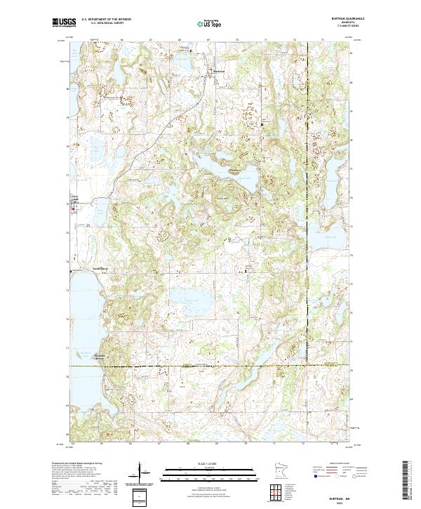
2022 Map of Burtrum
USGS Topo · Published 2022About this map
Burtrum and the nearby village of Grey Eagle sit at the center of a dense glacial landscape defined by dozens of small lakes and winding watercourses. This contemporary survey documents the complex boundary intersections where Todd, Morrison, and Stearns counties meet. The presence of several historic burial grounds, including the Grand Army of the Republic Cem and Old Saint Marys Cem, provides essential points of reference for genealogists tracking early Central Minnesota families. Water dominates the geography, with the North Two River and South Two River draining the wetlands surrounding Big Birch Lake and Goose Lake. Small settlements like North Shore and Pleasant Beach line the lakefronts, illustrating how the region's hydrography has shaped residential development and local recreation over time.
Find a feature on this map
88 named features on this map. Tap any name to fly to it.
Don’t see what you’re looking for? This feature index may not catch every label — zoom into the map to look around manually.
Map Details
Editions of this 2022 Burtrum Map
This is the sole edition of this map. No revisions or reprints were ever made.
Other maps of this area

1947 · Flensburg
USGS Topo · 1:25,000

1950 · Swanville
USGS Topo · 1:62,500

1951 · Flensburg
USGS Topo · 1:25,000

1953 · Saint Cloud
USGS Topo · 1:250,000

1957 · Saint Cloud
USGS Topo · 1:250,000

1958 · Saint Cloud
USGS Topo · 1:250,000

1965 · Albany
USGS Topo · 1:24,000

1965 · Melrose
USGS Topo · 1:24,000

1965 · Freeport
USGS Topo · 1:24,000
1966 · Long Prairie
USGS Topo · 1:24,000