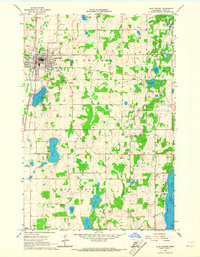
1966 Map of Long Prairie
USGS Topo · Published 1967About this map
The Long Prairie River and the Great Northern railroad corridor define the local geography of central Minnesota in the mid-1960s. The town of Long Prairie serves as the focal point, showing a developed street grid adjacent to its industrial and utility infrastructure, including a sewage disposal plant and a prominent Substation. The surrounding landscape is characterized by a high density of water bodies such as Charlotte Lake, Latimer Lake, and the expansive Big Swan Lake to the southeast. Genealogists and local researchers can locate several significant burial grounds, notably Lutheran Cem, St Mary Cem, and Long Prairie Cem. The rural outskirts are dotted with small-scale industry and landmarks of the era, from numerous Gravel Pits to a drive-in theater and a central Townhall.
Find a feature on this map
34 named features on this map. Tap any name to fly to it.
Don’t see what you’re looking for? This feature index may not catch every label — zoom into the map to look around manually.
Map Details
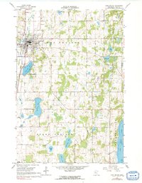
Editions of this 1966 Long Prairie Map
2 editions found
Other maps of this area

1948 · Cushing
USGS Topo · 1:62,500

1950 · Swanville
USGS Topo · 1:62,500

1950 · Cushing
USGS Topo · 1:62,500

1953 · Brainerd
USGS Topo · 1:250,000

1953 · Saint Cloud
USGS Topo · 1:250,000

1957 · Brainerd
USGS Topo · 1:250,000

1957 · Saint Cloud
USGS Topo · 1:250,000

1958 · Saint Cloud
USGS Topo · 1:250,000

1958 · Brainerd
USGS Topo · 1:250,000

1965 · Brainerd
USGS Topo · 1:250,000