
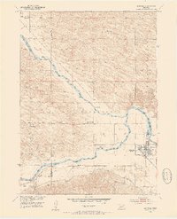
1952 Map of Burwell
USGS Topo · Published 1954About this map
The town of Burwell serves as the focal point of this 1952 survey, situated at the confluence where the Calamus River meets the North Loup River. The landscape is defined by the early irrigation and transportation networks of central Nebraska, featuring the Taylor Ord Canal and the Chicago Burlington and Quincy railroad line terminating in the village. This era shows a high density of rural school districts and family landmarks, including Goldenrod Sch and Parker Cem, which served the farming communities spread across the river valleys.
Find a feature on this map
29 named features on this map. Tap any name to fly to it.
Don’t see what you’re looking for? This feature index may not catch every label — zoom into the map to look around manually.
Map Details
Editions of this 1952 Burwell Map
2 editions found
Other maps of this area

1952 · Sargent East
USGS Topo · 1:24,000

1952 · Elyria
USGS Topo · 1:24,000

1952 · Burwell SE
USGS Topo · 1:24,000

1952 · Burwell NE
USGS Topo · 1:24,000

1952 · Taylor SE
USGS Topo · 1:24,000

1952 · Comstock NW
USGS Topo · 1:24,000

1952 · Burwell NW
USGS Topo · 1:24,000

1952 · Taylor NE
USGS Topo · 1:24,000

1955 · Broken Bow
USGS Topo · 1:250,000

1956 · Broken Bow
USGS Topo · 1:250,000