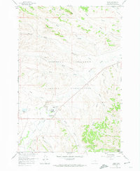
1958 Map of Busby
USGS Topo · Published 1974About this map
The Northern Cheyenne Indian Reservation landscape is defined by the winding course of Rosebud Creek and its many tributaries, such as Teeth Creek and Deafy Creek. The settlement of Busby serves as a local hub, home to the Busby Boarding Sch and the Busby Cem. A notable cultural landmark, the Historical Monument (Indian Chief Two Moons), stands near the creek, marking the history of the Cheyenne people in this region during the mid-20th century.
Find a feature on this map
28 named features on this map. Tap any name to fly to it.
Don’t see what you’re looking for? This feature index may not catch every label — zoom into the map to look around manually.
Map Details
Editions of this 1958 Busby Map
3 editions found
Other maps of this area

1894 · Rosebud
USGS Topo · 1:125,000

1901 · Rosebud
USGS Topo · 1:125,000

1954 · Hardin
USGS Topo · 1:250,000

1957 · Hardin
USGS Topo · 1:250,000

1958 · Hardin
USGS Topo · 1:250,000

1958 · Chalky Point
USGS Topo · 1:24,000

1958 · Painted Hill
USGS Topo · 1:24,000

1958 · Bull Creek Lookout
USGS Topo · 1:24,000

1958 · Black Spring
USGS Topo · 1:24,000

1958 · Busby
USGS Topo · 1:24,000