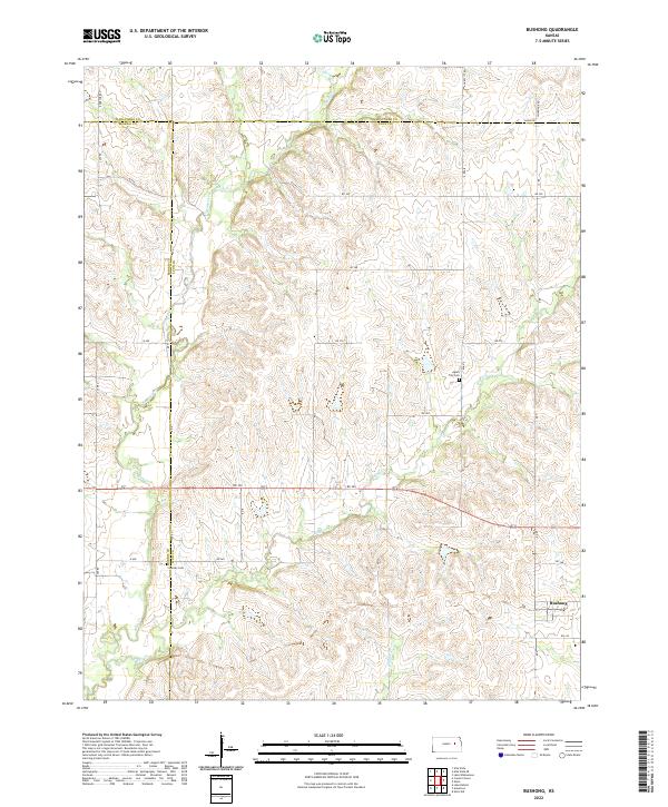
2022 Map of Bushong
USGS Topo · Published 2022About this map
Bushong sits at the intersection of RD 330 and Road E, serving as a central point in this rural landscape where Lyon, Morris, and Wabaunsee counties converge. The terrain is defined by a dense network of drainage systems, most notably Bluff Creek and Rock Cr, which carve through the Flint Hills region. These waterways dictated the placement of early infrastructure, influencing the winding paths of rural routes like Agnes City Rd and Chalk Rd.
Find a feature on this map
36 named features on this map. Tap any name to fly to it.
Don’t see what you’re looking for? This feature index may not catch every label — zoom into the map to look around manually.
Map Details
Editions of this 2022 Bushong Map
This is the sole edition of this map. No revisions or reprints were ever made.
Other maps of this area

1885 · Eskridge
USGS Topo · 1:125,000

1889 · Eskridge
USGS Topo · 1:125,000

1894 · Eskridge
USGS Topo · 1:125,000

1955 · Hutchinson
USGS Topo · 1:250,000

1959 · Hutchinson
USGS Topo · 1:250,000

1971 · Alta Vista SE
USGS Topo · 1:24,000

1971 · Allen
USGS Topo · 1:24,000

1971 · Bushong
USGS Topo · 1:24,000

1971 · Alta Vista
USGS Topo · 1:24,000
1971 · Lake Wabaunsee
USGS Topo · 1:24,000