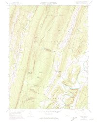
1959 Map of Butler Knob
USGS Topo · Published 1972About this map
Jacks Mountain and the surrounding ridges of Huntingdon County dominate this mid-century topographic portrait, showing a landscape defined by steep gaps and narrow valleys. The settlement of Shirleysburg and the nearby Allenport anchor the eastern edge of the map, where Aughwick Creek winds through the lowlands below Chestnut Hill. The area's rural character is underscored by numerous small houses of worship and burial grounds, including Beech Run Ch, Sugar Run Ch, and the Barr-Garver Cem.
Find a feature on this map
64 named features on this map. Tap any name to fly to it.
Don’t see what you’re looking for? This feature index may not catch every label — zoom into the map to look around manually.
Map Details
Editions of this 1959 Butler Knob Map
3 editions found

Other maps of this area

1901 · Huntingdon
USGS Topo · 1:62,500

1904 · Huntingdon
USGS Topo · 1:62,500

1922 · Mt Union
USGS Topo · 1:48,000

1924 · Mt. Union
USGS Topo · 1:62,500

1930 · Broad Top
USGS Topo · 1:62,500

1933 · Broad Top
USGS Topo · 1:62,500

1939 · Orbisonia
USGS Topo · 1:62,500

1940 · Orbisonia
USGS Topo · 1:62,500

1944 · Orbisonia
USGS Topo · 1:62,500

1944 · Mt. Union
USGS Topo · 1:62,500
Featured Places
- Cass Township, PA
- Union Township, PA
- Cromwell Township, PA
- Shirley Township, PA
- Latta Grove, Cass Township