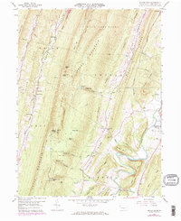
1959 Map of Butler Knob
USGS Topo · Published 1972About this map
Jacks Mountain and the parallel Chestnut Ridge dominate this central Pennsylvania landscape, defining the narrow agricultural valleys and steep forested gaps of the Ridge-and-Valley province. This 1959 survey, updated in the early 1970s, documents the rural infrastructure of Hares Valley and the Aughwick Creek corridor before major modern expansions. Local community life is anchored by country churches like Beech Run Ch and Latta Grove Ch, alongside numerous family-named cemeteries such as the Bare-Garver Cem and Schwartz Cem. The ridge crests are largely preserved as State Game Lands No 71 and State Forest, though the presence of the Butler Knob Lockout Tower and a nearby Microwave Tower signals the era's evolving communication and surveillance networks. Along the eastern edge, the Shirleysburg Boro Bdy and the Mount Union Airport mark the transition toward more developed transportation and municipal hubs.
Find a feature on this map
68 named features on this map. Tap any name to fly to it.
Don’t see what you’re looking for? This feature index may not catch every label — zoom into the map to look around manually.
Map Details
Editions of this 1959 Butler Knob Map
3 editions found

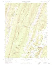
Other maps of this area

1901 · Huntingdon
USGS Topo · 1:62,500

1904 · Huntingdon
USGS Topo · 1:62,500

1922 · Mt Union
USGS Topo · 1:48,000

1924 · Mt. Union
USGS Topo · 1:62,500

1930 · Broad Top
USGS Topo · 1:62,500

1933 · Broad Top
USGS Topo · 1:62,500

1939 · Orbisonia
USGS Topo · 1:62,500

1940 · Orbisonia
USGS Topo · 1:62,500

1944 · Orbisonia
USGS Topo · 1:62,500

1944 · Mt. Union
USGS Topo · 1:62,500
Featured Places
- Cass Township, PA
- Union Township, PA
- Cromwell Township, PA
- Shirley Township, PA
- Latta Grove, Cass Township