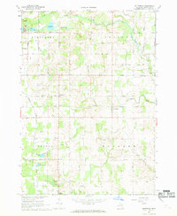
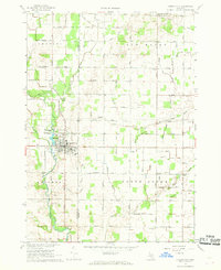
1967 Map of Butternut
USGS Topo · Published 1969About this map
Fish Creek and its many tributaries wind through the agricultural landscape of Evergreen, Crystal, Bushnell, and Bloomer townships during the late 1960s. The region is dotted with several small glacial lakes, including Muskrat Lake, Mud Lake, and Cedar Lake in the north, while Hammell Lake and Pickerel Lake occupy the southern reaches. The settlement of Vickeryville serves as a local hub, accompanied by the Vickeryville Cem to the south.
Find a feature on this map
35 named features on this map. Tap any name to fly to it.
Don’t see what you’re looking for? This feature index may not catch every label — zoom into the map to look around manually.
Map Details
Editions of this 1967 Butternut Map
2 editions found
Other maps of this area

1954 · Midland
USGS Topo · 1:250,000

1958 · Midland
USGS Topo · 1:250,000

1959 · Midland
USGS Topo · 1:250,000

1964 · Stanton
USGS Topo · 1:24,000

1965 · Sumner
USGS Topo · 1:24,000

1965 · Crystal
USGS Topo · 1:24,000

1966 · Midland
USGS Topo · 1:250,000
1967 · Palo
USGS Topo · 1:24,000
1967 · Hubbardston
USGS Topo · 1:24,000
1967 · Carson City
USGS Topo · 1:24,000