1961 Map of Buttes
USGS Topo · Published 1974About this map
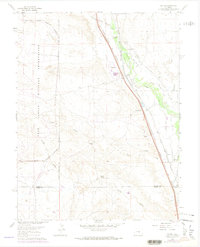
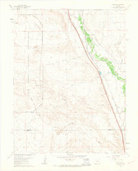
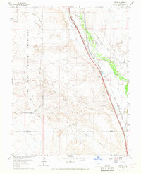
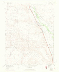
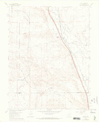
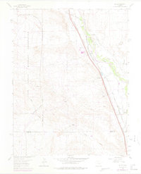
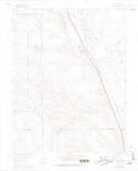
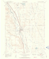
Fort Carson Military Reservation occupies the western portion of this landscape, its boundary roads and military terrain contrasting with the agricultural and transport corridor to the east. Parallel rail lines, the Atchison Topeka and Santa Fe and the Denver and Rio Grande Western, run southeast alongside Fountain Creek, dictating the placement of small sidings and communities like Buttes and Henkel. A complex network of irrigation channels, including the Tom Wanless Ditch and Hanover Ditch, draws water from the creek to support local ranching operations such as the 7 L Bar Ranch and Midway Ranch. The small settlement of Wigwam is notable for its proximity to the Wigwam Sch, suggesting a concentrated rural community center during the mid-20th century. Terrain features like Young Hollow and Sand Creek cut through the arid landscape, marked by local landmarks like Cocklebur Spring.
Find a feature on this map
30 named features on this map. Tap any name to fly to it.
Don’t see what you’re looking for? This feature index may not catch every label — zoom into the map to look around manually.
Map Details
Editions of this 1961 Buttes Map
8 editions found

Other maps of this area

1891 · Pueblo
USGS Topo · 1:125,000

1893 · Colorado Springs
USGS Topo · 1:125,000

1894 · Pueblo
USGS Topo · 1:125,000

1896 · Pueblo
USGS Topo · 1:125,000

1897 · Pueblo
USGS Topo · 1:125,000

1909 · Colorado Springs
USGS Topo · 1:125,000

1942 · Colorado Springs
USGS Topo · 1:125,000

1948 · Timber Mountain
USGS Topo · 1:24,000

1948 · Fountain SE
USGS Topo · 1:24,000
1948 · Fountain
USGS Topo · 1:24,000