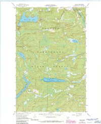
1967 Map of Buyck
USGS Topo · Published 1986About this map
The Vermillion River flows through the northeastern corner of this landscape, marking a transition between the Superior National Forest Boundary and the expansive Kabetogama State Forest. Near the river, the small settlement of Buyck serves as a local focal point, containing the Buyck Sch and St Joseph Ch. The surrounding terrain in Beatty is characterized by a dense network of lakes and waterways, including Kjostad Lake, Olive Lake, and the centrally located Winchester Lake.
Find a feature on this map
20 named features on this map. Tap any name to fly to it.
Don’t see what you’re looking for? This feature index may not catch every label — zoom into the map to look around manually.
Map Details
Editions of this 1967 Buyck Map
2 editions found
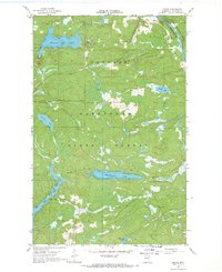
Other maps of this area

1954 · Hibbing
USGS Topo · 1:250,000

1954 · International Falls
USGS Topo · 1:250,000

1956 · Vermilion Dam
USGS Topo · 1:24,000

1957 · Hibbing
USGS Topo · 1:250,000

1957 · International Falls
USGS Topo · 1:250,000

1958 · International Falls
USGS Topo · 1:250,000

1958 · Hibbing
USGS Topo · 1:250,000

1963 · Echo Lake
USGS Topo · 1:24,000

1963 · Picket Lake
USGS Topo · 1:24,000

1964 · Hibbing
USGS Topo · 1:250,000