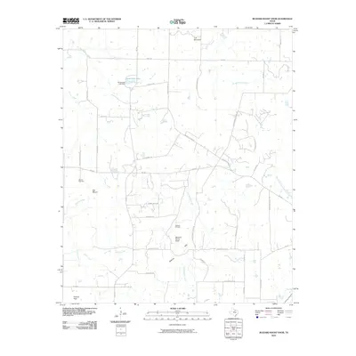
2010 Map of Buzzard Roost Knob
USGS Topo · Published 2010About this map
Buzzard Roost Knob and the Belknap Hills anchor this high-elevation pocket of Montague County, characterized by a complex network of creeks and legacy road systems. The landscape is defined by its drainage basins, where the headwaters of East Belknap Creek, Victoria Creek, and Polecat Creek carve through the terrain. The influence of mid-century petroleum development is evident at the Hildreth Oil Field, while the area's agricultural and educational history is preserved in the names of thoroughfares like Indian School Rd, Eureka School Rd, and Woodland School Rd. Toward the north, Hinds Clark Lake and its associated Hinds Clark Lake Dam provide a rare significant water body in this upland environment. The presence of Oak Hill Cemetery and prominent summits like Queens Peak and Colt Mountain offer fixed points for genealogical and topographic research.
Find a feature on this map
42 named features on this map. Tap any name to fly to it.
Don’t see what you’re looking for? This feature index may not catch every label — zoom into the map to look around manually.
Map Details
Editions of this 2010 Buzzard Roost Knob Map
This is the sole edition of this map. No revisions or reprints were ever made.
Other maps of this area

1905 · Montague
USGS Topo · 1:125,000

1954 · Sherman
USGS Topo · 1:250,000

1958 · Sherman
USGS Topo · 1:250,000

1960 · Buzzard Roost Knob
USGS Topo · 1:24,000

1961 · Stoneburg
USGS Topo · 1:24,000

1961 · Salona
USGS Topo · 1:24,000

1961 · Brushy Mound
USGS Topo · 1:24,000

1961 · Montague
USGS Topo · 1:24,000

1961 · Bowie
USGS Topo · 1:24,000

1968 · Nocona
USGS Topo · 1:24,000