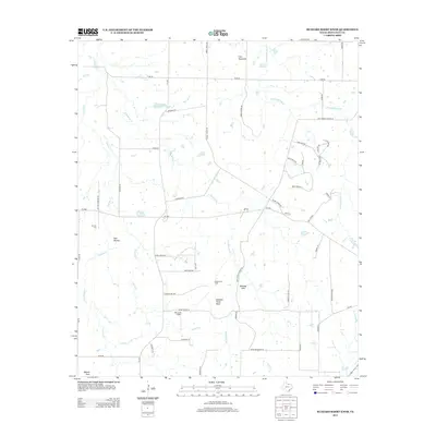
2013 Map of Buzzard Roost Knob
USGS Topo · Published 2013About this map
Buzzard Roost Knob rises as a prominent landmark in this section of Montague County, overlooking a landscape defined by rolling hills and traditional Texas ranching and resource extraction. The area is marked by a complex network of creeks, including E Belknap Cr, Barrel Springs Cr, and Victoria Cr, which feed local water features such as Hinds Clark Lake. The mid-20th-century energy footprint is evident at the Hildreth Oil Field and the Sky Acres Airport, while the local heritage is preserved at Oak Hill Cem. Historical education patterns are reflected in the naming of rural thoroughfares like Rock Springs School Rd and Eureka School Rd. From the elevation of Queens Peak in the south to Colt Mountain in the north, this survey documents the persistent rural character and geographic features of the North Texas interior.
Find a feature on this map
57 named features on this map. Tap any name to fly to it.
Don’t see what you’re looking for? This feature index may not catch every label — zoom into the map to look around manually.
Map Details
Editions of this 2013 Buzzard Roost Knob Map
This is the sole edition of this map. No revisions or reprints were ever made.
Other maps of this area

1905 · Montague
USGS Topo · 1:125,000

1954 · Sherman
USGS Topo · 1:250,000

1958 · Sherman
USGS Topo · 1:250,000

1960 · Buzzard Roost Knob
USGS Topo · 1:24,000

1961 · Stoneburg
USGS Topo · 1:24,000

1961 · Salona
USGS Topo · 1:24,000

1961 · Brushy Mound
USGS Topo · 1:24,000

1961 · Montague
USGS Topo · 1:24,000

1961 · Bowie
USGS Topo · 1:24,000

1968 · Nocona
USGS Topo · 1:24,000