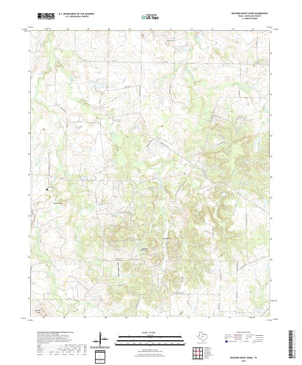
2022 Map of Buzzard Roost Knob
USGS Topo · Published 2022About this map
Buzzard Roost Knob and Belknap Hills dominate the topography of this Montague County landscape, where the terrain transitions between high points like Colt Mtn and Queens Peak. The area is defined by a dense network of drainage, with Victoria Cr, Polecat Cr, and E Belknap Cr carving through the countryside. Evidence of local community life is scattered along the rural road network, including the Oak Hill Cem and the settlement at Red Mound.
Find a feature on this map
56 named features on this map. Tap any name to fly to it.
Don’t see what you’re looking for? This feature index may not catch every label — zoom into the map to look around manually.
Map Details
Editions of this 2022 Buzzard Roost Knob Map
This is the sole edition of this map. No revisions or reprints were ever made.
Other maps of this area

1905 · Montague
USGS Topo · 1:125,000

1954 · Sherman
USGS Topo · 1:250,000

1958 · Sherman
USGS Topo · 1:250,000

1960 · Buzzard Roost Knob
USGS Topo · 1:24,000

1961 · Stoneburg
USGS Topo · 1:24,000

1961 · Salona
USGS Topo · 1:24,000

1961 · Brushy Mound
USGS Topo · 1:24,000

1961 · Montague
USGS Topo · 1:24,000

1961 · Bowie
USGS Topo · 1:24,000

1968 · Nocona
USGS Topo · 1:24,000