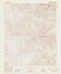
1986 Map of Buzzard Spring
USGS Topo · Published 1987About this map
Mining operations and arid landforms dominate the landscape of the Eagle Mountains in this mid-1980s topographical study. The northern portion of the sheet is marked by industrial activity, particularly at the Eagle Mountain Mine where a significant Mine Dump is noted near the Iron Chief Mine. These large-scale extractions contrast with smaller historical claims scattered through the desert terrain, including the evocatively named Mission Sweet Mine and Rainbows End Mine. Hydrology in this part of Riverside County is characterized by ephemeral features like Big Wash and Eagle Creek, which highlight the drainage patterns of the high desert. The presence of Buzzard Spring serves as a critical point of interest, representing one of the few named water sources in an otherwise dry and formidable mountain range.
Find a feature on this map
13 named features on this map. Tap any name to fly to it.
Don’t see what you’re looking for? This feature index may not catch every label — zoom into the map to look around manually.
Map Details
Editions of this 1986 Buzzard Spring Map
2 editions found
Other maps of this area

1940 · Canyon Spring
USGS Topo · 1:62,500

1943 · Canyon Spring
USGS Topo · 1:62,500

1943 · Coxcomb Mountains
USGS Topo · 1:62,500

1944 · Eagle Tank
USGS Topo · 1:62,500

1944 · Chuckwalla Mountains
USGS Topo · 1:62,500

1944 · Coxcomb Mountains
USGS Topo · 1:62,500

1954 · Salton Sea
USGS Topo · 1:250,000

1955 · Salton Sea
USGS Topo · 1:250,000

1959 · Salton Sea
USGS Topo · 1:250,000

1963 · Salton Sea
USGS Topo · 1:250,000