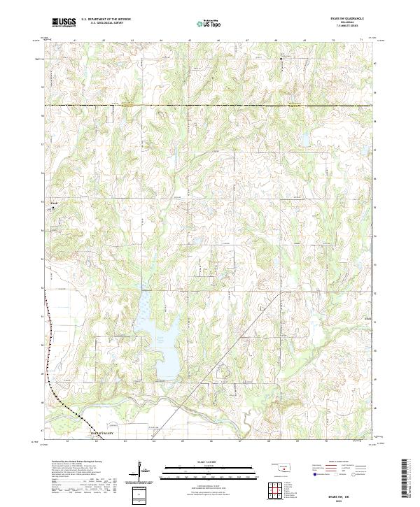
2022 Map of Byars SW
USGS Topo · Published 2022About this map
Pauls Valley Lake serves as a central geographic focus in this section of central Oklahoma, where the prairie landscape transitions into the rolling drainage basins of the Washita River. The mapping reveals a rural infrastructure defined by the original land partitions of the Indian Meridian Ave, which forms the western boundary of several townships. Small agricultural communities like Paoli and Civit anchor the local economy, while the presence of the Paoli Cem and the Fort Family Cem provide important genealogical touchpoints for those tracing early Oklahoma family histories.
Find a feature on this map
67 named features on this map. Tap any name to fly to it.
Don’t see what you’re looking for? This feature index may not catch every label — zoom into the map to look around manually.
Map Details
Editions of this 2022 Byars SW Map
This is the sole edition of this map. No revisions or reprints were ever made.
Other maps of this area

1898 · Pauls Valley
USGS Topo · 1:125,000

1902 · Pauls Valley
USGS Topo · 1:125,000

1957 · Ardmore
USGS Topo · 1:250,000

1963 · Ardmore
USGS Topo · 1:250,000

1964 · Byars
USGS Topo · 1:24,000

1965 · Pauls Valley NE
USGS Topo · 1:24,000
1965 · Rosedale
USGS Topo · 1:24,000

1965 · Byars SW
USGS Topo · 1:24,000
1965 · Wayne
USGS Topo · 1:24,000

1965 · Pauls Valley
USGS Topo · 1:24,000