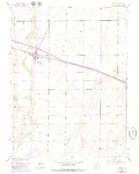
1956 Map of Byers
USGS Topo · Published 1979About this map
Byers serves as the focal point of this Eastern Plains landscape, situated at the crossing of the Union Pacific railroad and the erratic path of West Bijou Creek. The town's layout in the late 1950s shows a compact grid punctuated by essential community markers, including a Cem on the southern edge and several Wells indicating the critical reliance on groundwater in this arid environment. To the east, the rural character is defined by broad drainages like Rattlesnake Creek and the man-made Hopewell Ditch, which reflects early efforts to manage water for local agriculture.
Find a feature on this map
13 named features on this map. Tap any name to fly to it.
Don’t see what you’re looking for? This feature index may not catch every label — zoom into the map to look around manually.
Map Details
Editions of this 1956 Byers Map
5 editions found
Other maps of this area

1950 · Roper School
USGS Topo · 1:24,000

1951 · Roper School
USGS Topo · 1:24,000

1951 · Leader SE
USGS Topo · 1:24,000

1952 · Leader SW
USGS Topo · 1:24,000

1953 · Denver
USGS Topo · 1:250,000

1955 · Strasburg
USGS Topo · 1:24,000

1956 · Peoria
USGS Topo · 1:24,000

1956 · Byers
USGS Topo · 1:24,000

1957 · Denver
USGS Topo · 1:250,000

1958 · Denver
USGS Topo · 1:250,000