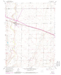
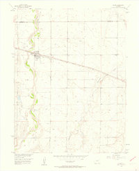
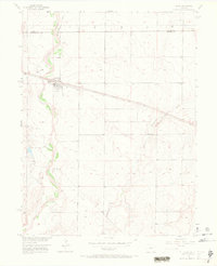
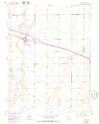
1956 Map of Byers
USGS Topo · Published 1985About this map
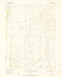
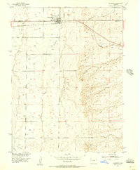
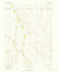
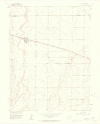
Byers sits at a critical junction of transportation and topography in the High Plains, where the Union Pacific railroad parallels the winding course of West Bijou Creek. This 1956 survey, updated with late 1970s revisions, illustrates the township's reliance on both rail and water, with irrigation features like the Hopewell Ditch supporting agricultural life on the plains. Beyond the main settlement, the map traces a landscape of ranch roads and remote landmarks, including the Bellview area and a local Sch and Cem that served the surrounding rural population. The terrain is defined by the drainages of Rattlesnake Creek and various unnamed draws, showing the transition from the creek bottoms to the higher, dryland grazing areas. For those tracing regional history, the alignment of Bijou Road and Exmore Road provides a clear view of the mid-century county infrastructure.
Find a feature on this map
13 named features on this map. Tap any name to fly to it.
Don’t see what you’re looking for? This feature index may not catch every label — zoom into the map to look around manually.
Map Details
Editions of this 1956 Byers Map
5 editions found
Other maps of this area

1950 · Roper School
USGS Topo · 1:24,000

1951 · Roper School
USGS Topo · 1:24,000
1951 · Leader SE
USGS Topo · 1:24,000

1952 · Leader SW
USGS Topo · 1:24,000

1953 · Denver
USGS Topo · 1:250,000
1955 · Strasburg
USGS Topo · 1:24,000
1956 · Peoria
USGS Topo · 1:24,000
1956 · Byers
USGS Topo · 1:24,000

1957 · Denver
USGS Topo · 1:250,000

1958 · Denver
USGS Topo · 1:250,000