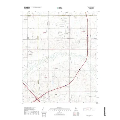
2018 Map of Byhalia NW
USGS Topo · Published 2018About this map
Piperton and Byhalia anchor this 2018 survey of the borderlands where Fayette and Shelby Counties in Tennessee meet Marshall and DeSoto Counties in Mississippi. The map illustrates a landscape in transition, where established rural communities like Barton and Handy Corner are increasingly interconnected by modern corridors like Goodman Rd. This era of the region is defined by its numerous small burial grounds, including Shiloh Cem, Coldwater Cem, and McGeehee Cem, which serve as vital markers for genealogical research in this multi-county junction.
Find a feature on this map
112 named features on this map. Tap any name to fly to it.
Don’t see what you’re looking for? This feature index may not catch every label — zoom into the map to look around manually.
Map Details
Editions of this 2018 Byhalia NW Map
This is the sole edition of this map. No revisions or reprints were ever made.
Other maps of this area

1943 · Collierville
USGS Topo · 1:62,500

1944 · Hernando
USGS Topo · 1:62,500

1948 · Byhalia
USGS Topo · 1:62,500

1953 · Collierville
USGS Topo · 1:50,000

1956 · Blytheville
USGS Topo · 1:250,000

1956 · Tupelo
USGS Topo · 1:250,000

1958 · Tupelo
USGS Topo · 1:250,000

1959 · Blytheville
USGS Topo · 1:250,000

1960 · Bartlett
USGS Topo · 1:62,500

1961 · Bartlett
USGS Topo · 1:62,500