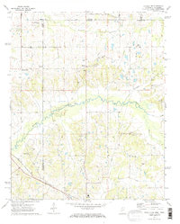
1971 Map of Byhalia NW
USGS Topo · Published 1973About this map
The Tennessee Mississippi state line bisects the northern reaches of this landscape, where the rural crossroads of Handy Corner and Barton serve as local anchors. The terrain is defined by the winding course of the Coldwater River and its tributaries, including Nonconnah Creek and Lee Creek. This 1971-checked survey captures a region transitioning from agrarian roots to a more connected infrastructure, evidenced by the diagonal path of the St Louis San Francisco railroad and the presence of the Colonial Landing Strip.
Find a feature on this map
33 named features on this map. Tap any name to fly to it.
Don’t see what you’re looking for? This feature index may not catch every label — zoom into the map to look around manually.
Map Details
Editions of this 1971 Byhalia NW Map
2 editions found
Other maps of this area

1943 · Collierville
USGS Topo · 1:62,500

1944 · Hernando
USGS Topo · 1:62,500

1948 · Byhalia
USGS Topo · 1:62,500

1953 · Collierville
USGS Topo · 1:50,000

1956 · Blytheville
USGS Topo · 1:250,000

1956 · Tupelo
USGS Topo · 1:250,000

1958 · Tupelo
USGS Topo · 1:250,000

1959 · Blytheville
USGS Topo · 1:250,000

1960 · Bartlett
USGS Topo · 1:62,500

1961 · Bartlett
USGS Topo · 1:62,500