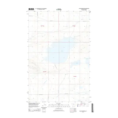
2014 Map of Bynum Reservoir
USGS Topo · Published 2014About this map
Bynum Reservoir dominates this landscape in Teton County, serving as a critical node in the local irrigation network. The map details a complex water management system including the Bynum Reservoir Ditch and the nearby Farmers Reservoir, which capture runoff from the eastern slopes of the Rocky Mountain Front. The drainage patterns are defined by several eastern-flowing waterways, most notably the Teton River in the south and Muddy Cr to the north. Historical access routes like Blackleaf Rd and Teton Canyon Rd track the section lines of the Public Land Survey System, providing a clear view of how rural infrastructure aligns with the township and range grid. Small water bodies like Harvey Lake and named drainages such as Blacktail Cr and Miller Cr punctuate the open terrain, illustrating the hydrological significance of this region to Montana agriculture.
Find a feature on this map
20 named features on this map. Tap any name to fly to it.
Don’t see what you’re looking for? This feature index may not catch every label — zoom into the map to look around manually.
Map Details
Editions of this 2014 Bynum Reservoir Map
This is the sole edition of this map. No revisions or reprints were ever made.
Other maps of this area

1903 · Saypo
USGS Topo · 1:125,000

1914 · Heart Butte
USGS Topo · 1:125,000

1918 · Heart Butte
USGS Topo · 1:125,000

1920 · Choteau
USGS Topo · 1:125,000

1920 · Dupuyer
USGS Topo · 1:125,000

1936 · Pendroy
USGS Topo · 1:48,000

1941 · Pendroy
USGS Topo · 1:62,500

1955 · Choteau
USGS Topo · 1:250,000

1957 · Choteau
USGS Topo · 1:250,000

1958 · Choteau
USGS Topo · 1:250,000