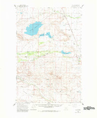
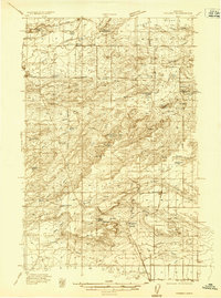
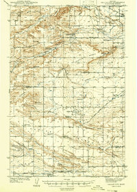
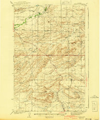
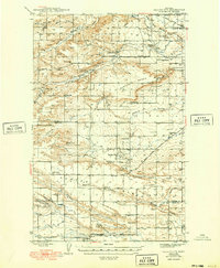
1960 Map of Bynum
USGS Topo · Published 1982About this map
Bynum and the surrounding ranchlands of Teton County are defined by a complex network of water management and rail transport as they appeared in 1960. The Great Northern railroad cuts a straight diagonal through the eastern territory, linking the settlement of Bynum with the communal Miller Colony and smaller ranching outposts like Ralston. This arid landscape is transformed by an intricate system of irrigation, featuring the Bynum Reservoir, Farmers Reservoir, and Eureka Reservoir. These man-made bodies, connected by the Eldorado Ditch and Farmers Ditch, divert the waters of the Teton River to support a high-plains agricultural economy. Local history is preserved in the location of the Tetonview Sch and several family-named landmarks such as Monkman Ranch and Armstrong Ranch. To the south, the terrain rises into the Teton Buttes, while the Teton-Spring Creek Bird Preserve marks a protected corridor along the river's path.
Find a feature on this map
54 named features on this map. Tap any name to fly to it.
Don’t see what you’re looking for? This feature index may not catch every label — zoom into the map to look around manually.
Map Details
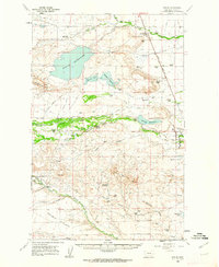
Editions of this 1960 Bynum Map
2 editions found
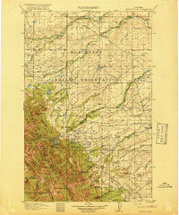
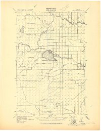
Other maps of this area

1903 · Saypo
USGS Topo · 1:125,000

1914 · Heart Butte
USGS Topo · 1:125,000
1918 · Heart Butte
USGS Topo · 1:125,000

1920 · Choteau
USGS Topo · 1:125,000
1920 · Dupuyer
USGS Topo · 1:125,000
1936 · Pendroy
USGS Topo · 1:48,000
1938 · Gallup City
USGS Topo · 1:62,500
1941 · Pendroy
USGS Topo · 1:62,500
1942 · Gallup City
USGS Topo · 1:62,500

1955 · Choteau
USGS Topo · 1:250,000