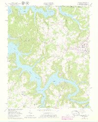
1962 Map of Byrdstown
USGS Topo · Published 1979About this map
Dale Hollow Lake dominates this landscape, its fingers reaching deep into the hollows of Pickett and Overton Counties. Created by the damming of the Obey River, the reservoir surrounds high ridges and submerged valleys, leaving isolated settlements like Bloomington and Star Point near its irregular shoreline. The map captures a moment of transition where old river-bottom life adjusted to the new water levels, preserved here through numerous family cemeteries and remote landmarks.
Find a feature on this map
68 named features on this map. Tap any name to fly to it.
Don’t see what you’re looking for? This feature index may not catch every label — zoom into the map to look around manually.
Map Details
Editions of this 1962 Byrdstown Map
4 editions found
Other maps of this area

1897 · Standingstone
USGS Topo · 1:125,000

1898 · Standingstone
USGS Topo · 1:125,000

1924 · Lillydale
USGS Topo · 1:62,500

1926 · Lillydale
USGS Topo · 1:62,500

1929 · Lillydale
USGS Topo · 1:62,500

1929 · Byrdstown
USGS Topo · 1:62,500

1944 · Livingston
USGS Topo · 1:24,000

1954 · Frogue
USGS Topo · 1:24,000

1954 · Albany
USGS Topo · 1:24,000

1954 · Savage
USGS Topo · 1:24,000