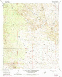
1963 Map of C Bar Ranch
USGS Topo · Published 1980About this map
The Continental Divide winds through this high-desert ranching landscape in southwestern New Mexico, defining the drainage patterns of the Gila National Forest. The map documents a scattered network of family-held operations, including the central C Bar Ranch, Glaze Ranch, and Jones Ranch. This 1963 survey (with 1978 updates) reveals how water management dictated life in the arid environment, with dozens of named wells, windmills, and tanks such as the Taylor Windmills and Glaze Reservoir providing the only reliable points of interest across the vast system of canyons.
Find a feature on this map
50 named features on this map. Tap any name to fly to it.
Don’t see what you’re looking for? This feature index may not catch every label — zoom into the map to look around manually.
Map Details
Editions of this 1963 C Bar Ranch Map
2 editions found
Other maps of this area

1909 · Silver City
USGS Topo · 1:125,000

1950 · White Signal
USGS Topo · 1:24,000

1950 · Burro Peak
USGS Topo · 1:24,000

1951 · White Signal
USGS Topo · 1:24,000

1951 · Big Burro Mountains
USGS Topo · 1:24,000

1954 · Silver City
USGS Topo · 1:250,000

1958 · Silver City
USGS Topo · 1:250,000

1959 · Redrock
USGS Topo · 1:62,500

1962 · Silver City
USGS Topo · 1:250,000

1962 · Ninetysix Ranch
USGS Topo · 1:24,000