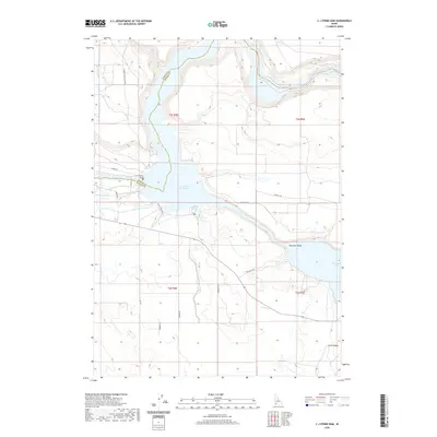
2020 Map of C J Strike Dam
USGS Topo · Published 2020About this map
The C J Strike Dam anchors this landscape at the convergence of the Snake and Bruneau rivers, defining a region where modern water management meets deep history. The impounded waters of the C J Strike Reservoir and its Bruneau Arm dominate the central terrain, yet traces of the westward expansion remain visible. The historic Emigrant Trl cuts across the southern portion of the quadrangle, serving as a reminder of the overland routes that preceded the current network of agricultural infrastructure. The reliance on water for the surrounding high desert is evident in the engineered paths of the Shoofly Canal and the S Side Canal, which sustain the irrigation-based economy of Bruneau Valley. From the small settlement at Little Valley to the narrow passage known as the Narrows, this map documents a critical point of industrial and agricultural development in southwestern Idaho.
Find a feature on this map
24 named features on this map. Tap any name to fly to it.
Don’t see what you’re looking for? This feature index may not catch every label — zoom into the map to look around manually.
Map Details
Editions of this 2020 C J Strike Dam Map
This is the sole edition of this map. No revisions or reprints were ever made.
Other maps of this area

1892 · Mountain Home
USGS Topo · 1:125,000

1892 · Bisuka
USGS Topo · 1:125,000

1893 · Mountain Home
USGS Topo · 1:125,000

1894 · Bisuka
USGS Topo · 1:125,000

1946 · Mouth of Bruneau
USGS Topo · 1:24,000

1947 · Little Valley
USGS Topo · 1:24,000

1947 · Grand View
USGS Topo · 1:62,500

1947 · Bruneau
USGS Topo · 1:62,500

1947 · Grand View
USGS Topo · 1:24,000

1947 · Bruneau
USGS Topo · 1:24,000