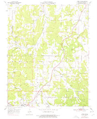
1951 Map of Cabool NE
USGS Topo · Published 1976About this map
The Big Piney River and its numerous tributaries, including Hamilton Creek and Potter Creek, define the landscape of this Missouri Ozarks region at the midpoint of the century. The settlement pattern is largely agricultural and decentralized, anchored by rural institutions such as Hamilton Creek Ch, Pleasant Grove Sch, and Oak Grove Sch. Near the northern edge of the sheet, the community of Simmons sits along the rail line, while the northern outskirts of Cabool appear at the southern margin near the Cabool Airport. Transportation and commerce are tied to the St Louis San Francisco railroad, which cuts through the eastern half of the area. For genealogists, the map is a detailed record of local family-named landmarks and resting places, from Alfis Cem to the Rocky Branch Cem in the northeast.
Find a feature on this map
30 named features on this map. Tap any name to fly to it.
Don’t see what you’re looking for? This feature index may not catch every label — zoom into the map to look around manually.
Map Details
Editions of this 1951 Cabool NE Map
4 editions found
Other maps of this area

1941 · Bado
USGS Topo · 1:62,500

1943 · Bado
USGS Topo · 1:62,500

1945 · Clear Springs
USGS Topo · 1:62,500

1948 · Clear Springs
USGS Topo · 1:62,500

1949 · Rolla
USGS Topo · 1:250,000

1950 · Cabool SW
USGS Topo · 1:24,000

1951 · Cabool SE
USGS Topo · 1:24,000

1951 · Houston
USGS Topo · 1:24,000

1951 · Cabool NW
USGS Topo · 1:24,000

1951 · Cabool NE
USGS Topo · 1:24,000