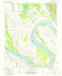
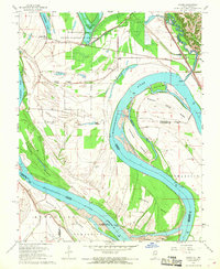
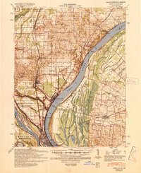
1967 Map of Cache
USGS Topo · Published 1979About this map
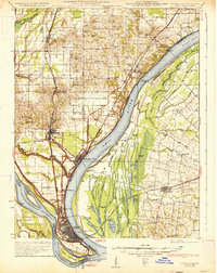
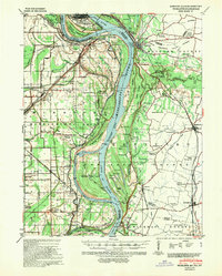
The Mississippi River creates a labyrinthine landscape of shifting channels and massive alluvial deposits along the Illinois-Missouri border. This survey details the complex hydrography of the Tywappity bend, where a network of large islands such as Dogtooth Island, Bumgard Island, and Buffalo Island dominates the river corridor. The presence of a significant Indian Mound near Lake Milligan points to an ancient human presence in this fertile floodplain, long before the establishment of modern settlements like Miller City and Cache.
Find a feature on this map
45 named features on this map. Tap any name to fly to it.
Don’t see what you’re looking for? This feature index may not catch every label — zoom into the map to look around manually.
Map Details
Editions of this 1967 Cache Map
2 editions found
Other maps of this area

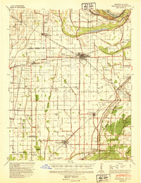
1931 · Cairo
USGS Topo · 1:62,500
1933 · Cairo
USGS Topo · 1:62,500

1934 · Thebes
USGS Topo · 1:62,500
1939 · Wickliffe
USGS Topo · 1:62,500
1939 · Charleston
USGS Topo · 1:62,500
1939 · Cairo
USGS Topo · 1:62,500

1939 · Thebes
USGS Topo · 1:62,500

1949 · Paducah
USGS Topo · 1:250,000

1950 · Paducah
USGS Topo · 1:250,000
1952 · Wickliffe
USGS Topo · 1:62,500