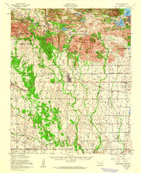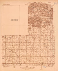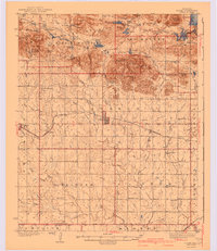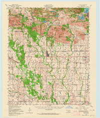
1956 Map of Cache
USGS Topo · Published 1964About this map
Wichita Mountains Wildlife Refuge and the northern reaches of the Fort Sill Military Reservation dominate this mid-century landscape in Comanche County. The map documents a transition from the complex rocky terrain of the mountains to the open prairie and agricultural lands to the south. Significant water management is visible through numerous named lakes like Lake Lawtonka, Quanah Parker Lake, and French Lake, which supported the surrounding military and civilian populations. The town of Cache serves as a central hub along the St Louis San Francisco railroad line, while Indiahoma sits near the western border. Local heritage sites are well-represented, including the Nazarene Indian Mission and several small burial grounds such as Dayo Cemetery and Pecan Cemetery, providing essential data for genealogical research into the area's diverse community history during the 1950s.
Find a feature on this map
72 named features on this map. Tap any name to fly to it.
Don’t see what you’re looking for? This feature index may not catch every label — zoom into the map to look around manually.
Map Details
Editions of this 1956 Cache Map
3 editions found