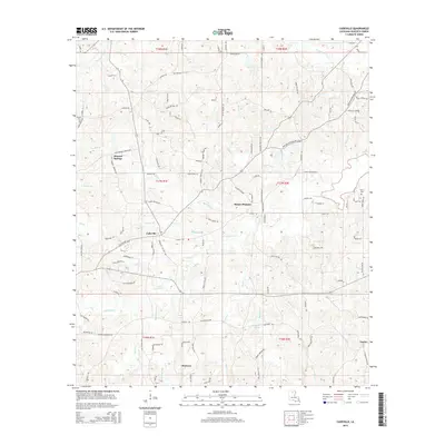
2015 Map of Cadeville
USGS Topo · Published 2015About this map
Cadeville and Mount Pleasant anchor this portion of Ouachita Parish, characterized by a dense network of creek branches and springs that feed into the larger basins of N Cheniere Cr and S Cheniere Cr. The landscape is defined by its water-rich geography, featuring landmarks such as Bogaloosa Spring and numerous family-named waterways like Harris Br and Sam Brown Cr. North of Okaloosa, the terrain rises toward Squirrel Ridge, while smaller rural settlements like Mineral Springs and Lapine are connected by a web of local roads named for established local families.
Find a feature on this map
128 named features on this map. Tap any name to fly to it.
Don’t see what you’re looking for? This feature index may not catch every label — zoom into the map to look around manually.
Map Details
Editions of this 2015 Cadeville Map
This is the sole edition of this map. No revisions or reprints were ever made.
Other maps of this area

1935 · Drew
USGS Topo · 1:62,500

1940 · Monroe
USGS Topo · 1:62,500

1952 · Calhoun
USGS Topo · 1:62,500

1953 · Chatham
USGS Topo · 1:62,500

1955 · Shreveport
USGS Topo · 1:250,000

1956 · Shreveport
USGS Topo · 1:250,000

1957 · Monroe North
USGS Topo · 1:62,500

1957 · West Monroe North
USGS Topo · 1:24,000

1957 · West Monroe South
USGS Topo · 1:24,000

1957 · Monroe South
USGS Topo · 1:62,500