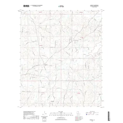
2018 Map of Cadeville
USGS Topo · Published 2018About this map
Cadeville and the surrounding pine-covered uplands of Ouachita Parish are defined by an intricate network of creeks and branches that drain toward the Cheniere Brake wetlands. In this modern survey, the landscape shows a transition from rural crossroads to residential clusters, with family names deeply embedded in the road network through routes like Carey Nelson Rd and Herman Dickerson Rd. Local history is centered around landmarks such as Antioch Church and small family burial grounds like Parker Cem. The hydrology is particularly detailed, tracing the distinct paths of N Cheniere Cr and S Cheniere Cr, along with numerous smaller tributaries like Booker Br and Mill Cr. Further south, the map documents the settlements of Okaloosa and Lapine, providing a clear view of the land divisions and forest management patterns that shape this portion of Northern Louisiana.
Find a feature on this map
125 named features on this map. Tap any name to fly to it.
Don’t see what you’re looking for? This feature index may not catch every label — zoom into the map to look around manually.
Map Details
Editions of this 2018 Cadeville Map
This is the sole edition of this map. No revisions or reprints were ever made.
Other maps of this area

1935 · Drew
USGS Topo · 1:62,500

1940 · Monroe
USGS Topo · 1:62,500

1952 · Calhoun
USGS Topo · 1:62,500

1953 · Chatham
USGS Topo · 1:62,500

1955 · Shreveport
USGS Topo · 1:250,000

1956 · Shreveport
USGS Topo · 1:250,000

1957 · Monroe North
USGS Topo · 1:62,500

1957 · West Monroe North
USGS Topo · 1:24,000

1957 · West Monroe South
USGS Topo · 1:24,000

1957 · Monroe South
USGS Topo · 1:62,500