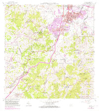
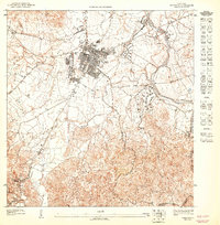
1964 Map of Caguas
USGS Topo · Published 1982About this map
Caguas serves as the focal point of this mid-century topographic record, showing the rapid expansion of the urban core into surrounding barrios like Turabo and Cañabón. The landscape is defined by the convergence of the Río Grande de Loíza and the Río Turabo, creating a valley surrounded by significant peaks such as Cerro Las Piñas. Notable for its high density of educational and religious institutions, the area includes the Escuela Superior Gautier Benítez and the Iglesia Evangélica Menonita.
Find a feature on this map
123 named features on this map. Tap any name to fly to it.
Don’t see what you’re looking for? This feature index may not catch every label — zoom into the map to look around manually.
Map Details
Editions of this 1964 Caguas Map
4 editions found
Other maps of this area

1946 · Patillas
USGS Topo · 1:30,000

1946 · Aguas Buenas
USGS Topo · 1:30,000

1946 · Cayey
USGS Topo · 1:30,000

1946 · Comerio
USGS Topo · 1:30,000

1946 · Naranjito
USGS Topo · 1:30,000

1946 · Gurabo
USGS Topo · 1:30,000

1946 · Juncos
USGS Topo · 1:30,000

1946 · Yabucoa
USGS Topo · 1:30,000

1946 · Caguas
USGS Topo · 1:30,000
1947 · Caguas NE
USGS Topo · 1:10,000
Featured Places
- Caguas
- Parque Mansiones de Navarro, Gurabo
- Comunidad Hacienda Ramonita, Caguas
- Sector Cheo Nieves, Caguas
- Sector La Unión, Caguas