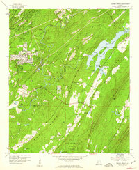
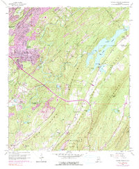
1959 Map of Cahaba Heights
USGS Topo · Published 1960About this map
The ridge-and-valley topography south of Birmingham is defined here by the winding Cahaba River and the substantial waters of Lake Purdy. In the late 1950s, the residential expansion of Cahaba Heights appears alongside established rural landmarks like Wooten Chapel Cem and Wise Cem. The landscape transitions from suburban development near the Jefferson and Shelby County line into the heavy timber and high ridges of Oak Mountain State Park to the south.
Find a feature on this map
50 named features on this map. Tap any name to fly to it.
Don’t see what you’re looking for? This feature index may not catch every label — zoom into the map to look around manually.
Map Details
Editions of this 1959 Cahaba Heights Map
5 editions found
Other maps of this area

1889 · Birmingham
USGS Topo · 1:125,000

1890 · Bessemer
USGS Topo · 1:125,000

1892 · Birmingham
USGS Topo · 1:125,000

1892 · Bessemer
USGS Topo · 1:125,000

1895 · Birmingham
USGS Topo · 1:125,000

1904 · Birmingham Coal District
USGS Topo · 1:62,500

1905 · Bessemer Iron District
USGS Topo · 1:62,500

1905 · Leeds
USGS Topo · 1:62,500

1906 · Birmingham Special
USGS Topo · 1:62,500

1906 · Vandiver
USGS Topo · 1:62,500