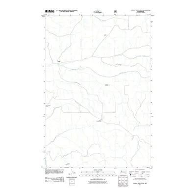
2011 Map of Cahill Mountain
USGS Topo · Published 2011About this map
Patit sits at the junction of several drainage systems in the Blue Mountain foothills of Columbia County. The landscape is defined by the carved paths of North Patit Creek and West Patit Creek, which slice through the plateau. A network of rural roads such as Malcolm Grade Rd and Starveout Rd connect the high ridges and deep hollows, tracing the difficult terrain between the creek beds and the high point at Cahill Mountain. Local landmarks like Pioneer Memorial Park and the Thorn Lookout Tower indicate a mix of community gathering spaces and forest management. This 2011 survey reveals how the modern road network follows historic natural corridors through Lewis Hollow and along Starvout Ridge.
Find a feature on this map
25 named features on this map. Tap any name to fly to it.
Don’t see what you’re looking for? This feature index may not catch every label — zoom into the map to look around manually.
Map Details
Editions of this 2011 Cahill Mountain Map
This is the sole edition of this map. No revisions or reprints were ever made.
Other maps of this area

1937 · Pomeroy
USGS Topo · 1:96,000

1942 · Pomeroy
USGS Topo · 1:125,000

1955 · Pullman
USGS Topo · 1:250,000

1958 · Pullman
USGS Topo · 1:250,000
1967 · Robinette Mtn.
USGS Topo · 1:24,000

1967 · Hopkins Ridge
USGS Topo · 1:24,000

1967 · Cahill Mtn
USGS Topo · 1:24,000

1967 · Turner
USGS Topo · 1:24,000
1967 · Dayton
USGS Topo · 1:24,000
1967 · Panjab Creek
USGS Topo · 1:24,000