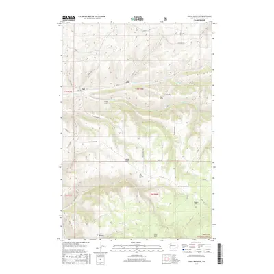
2017 Map of Cahill Mountain
USGS Topo · Published 2017About this map
Patit sits along the northern edge of this high-elevation landscape, where the grain fields and drainage systems of Columbia County meet the rising timberline. The area is defined by a dense network of steep drainages, including Cougar Canyon, Hatley Gulch, and Gates Gulch, which feed the various forks of Patit Cr. This complex topography was managed through a system of early ridge-running roads like Kendall Skyline Rd and Skyline Dr, which provided access to remote homesteads and timber resources.
Find a feature on this map
42 named features on this map. Tap any name to fly to it.
Don’t see what you’re looking for? This feature index may not catch every label — zoom into the map to look around manually.
Map Details
Editions of this 2017 Cahill Mountain Map
This is the sole edition of this map. No revisions or reprints were ever made.
Other maps of this area

1937 · Pomeroy
USGS Topo · 1:96,000

1942 · Pomeroy
USGS Topo · 1:125,000

1955 · Pullman
USGS Topo · 1:250,000

1958 · Pullman
USGS Topo · 1:250,000
1967 · Robinette Mtn.
USGS Topo · 1:24,000

1967 · Hopkins Ridge
USGS Topo · 1:24,000

1967 · Cahill Mtn
USGS Topo · 1:24,000

1967 · Turner
USGS Topo · 1:24,000
1967 · Dayton
USGS Topo · 1:24,000
1967 · Panjab Creek
USGS Topo · 1:24,000