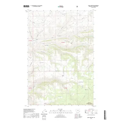
2020 Map of Cahill Mountain
USGS Topo · Published 2020About this map
Patit sits at the northern edge of a landscape defined by deep drainages and ridges in Columbia County. This area of southeast Washington is marked by a network of seasonal and perennial watercourses, including Patit Cr and its branches, N Patit Cr and W Patit Cr, which have carved significant features like Lewis Hollow and Cougar Canyon. The southern portion of the territory transitions into the higher elevations of the Umatilla National Forest, where the summit of Cahill Mtn stands as a prominent landmark.
Find a feature on this map
42 named features on this map. Tap any name to fly to it.
Don’t see what you’re looking for? This feature index may not catch every label — zoom into the map to look around manually.
Map Details
Editions of this 2020 Cahill Mountain Map
This is the sole edition of this map. No revisions or reprints were ever made.
Other maps of this area

1937 · Pomeroy
USGS Topo · 1:96,000

1942 · Pomeroy
USGS Topo · 1:125,000

1955 · Pullman
USGS Topo · 1:250,000

1958 · Pullman
USGS Topo · 1:250,000
1967 · Robinette Mtn.
USGS Topo · 1:24,000

1967 · Hopkins Ridge
USGS Topo · 1:24,000

1967 · Cahill Mtn
USGS Topo · 1:24,000

1967 · Turner
USGS Topo · 1:24,000
1967 · Dayton
USGS Topo · 1:24,000
1967 · Panjab Creek
USGS Topo · 1:24,000