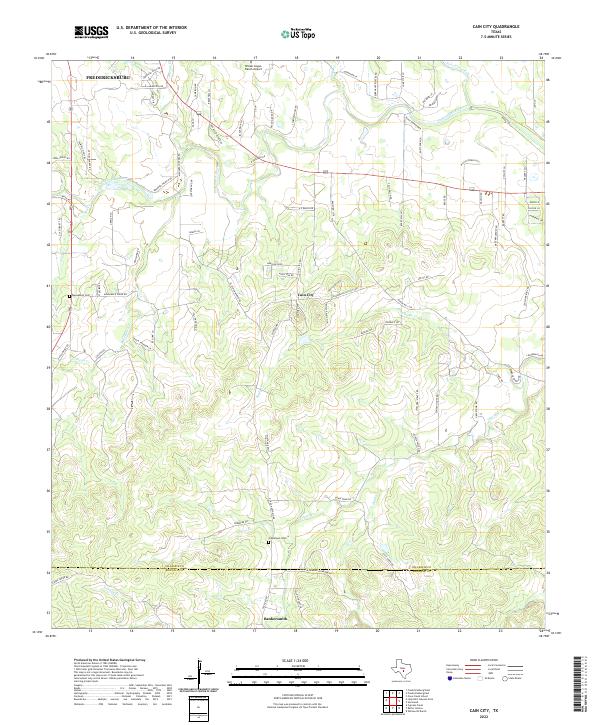
2022 Map of Cain City
USGS Topo · Published 2022About this map
The Pedernales River flows through the northern reaches of this Hill Country landscape, serving as a primary drainage for numerous creeks like Muesebach Cr and Snake Cr. The settlement of Cain City occupies a central position, reflecting a long-standing rural community network tied together by family-named roads such as Morales Duecker Rd and Kunz-Weinheimer. To the south, the village of Bankersmith sits near the Gillespie Co Kendall Co boundary, marking the southern edge of this survey.
Find a feature on this map
96 named features on this map. Tap any name to fly to it.
Don’t see what you’re looking for? This feature index may not catch every label — zoom into the map to look around manually.
Map Details
Editions of this 2022 Cain City Map
This is the sole edition of this map. No revisions or reprints were ever made.
Other maps of this area

1894 · Fredericksburg
USGS Topo · 1:125,000

1954 · Llano
USGS Topo · 1:250,000

1955 · Llano
USGS Topo · 1:250,000

1956 · Llano
USGS Topo · 1:250,000

1961 · Stonewall
USGS Topo · 1:24,000

1961 · Cave Creek School
USGS Topo · 1:24,000

1963 · Whitworth Ranch
USGS Topo · 1:24,000

1963 · Cain City
USGS Topo · 1:24,000

1964 · Oak Crest Park
USGS Topo · 1:24,000
1964 · Rafter Hollow
USGS Topo · 1:24,000