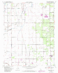
1950 Map of Cairns Corner
USGS Topo · Published 1982About this map
Agricultural development and water management define this Tulare County landscape, where the Outside Creek and Inside Creek weave through a network of irrigation ditches and leveled fields. The settlement of Plainview and the crossroads at Spinks Corner serve as anchors for a rigid grid of local roads, including Tulare Lindsay Highway and numerous numbered avenues. This 1950 survey, updated with 1969 revisions, documents the infrastructure of the Central Valley during a period of significant hydraulic engineering and land use intensification. Evidence of the region's aviation history is preserved through the Rankin Airfield and the Exeter-Lindsay Airport, while local landmarks like the Prairie Center Sch (Aban'd) and various claypits point to the social and industrial evolution of the rural community. The North Branch Tule River marks the southern edge of the survey, highlighting the critical role of water courses in shaping the local economy.
Find a feature on this map
37 named features on this map. Tap any name to fly to it.
Don’t see what you’re looking for? This feature index may not catch every label — zoom into the map to look around manually.
Map Details
Editions of this 1950 Cairns Corner Map
3 editions found
Other maps of this area

1925 · Rocky Hill
USGS Topo · 1:31,680

1925 · Tulare
USGS Topo · 1:31,680

1925 · Tipton
USGS Topo · 1:31,680

1926 · Exeter
USGS Topo · 1:31,680

1927 · Cairns Corner
USGS Topo · 1:31,680

1927 · Rocky Hill
USGS Topo · 1:31,680

1927 · Visalia
USGS Topo · 1:31,680

1927 · Tulare
USGS Topo · 1:31,680

1928 · Tipton
USGS Topo · 1:31,680

1928 · Woodville
USGS Topo · 1:31,680