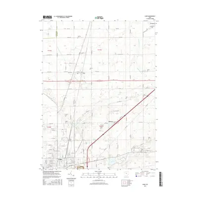
2016 Map of Cairo
USGS Topo · Published 2016About this map
Lima's northern outskirts and the agricultural corridor toward Cairo are defined by a network of rural roads and small burial grounds that reflect generations of settlement in Allen County. The landscape follows the drainage of the Ottawa River and its tributaries, including Sugar Cr and Rattlesnake Cr. This 2016 survey captures the area’s transition from the urban density of northern Lima to the smaller hamlets of Slabtown and Rockport. Genealogists will find a significant number of cemeteries recorded, such as the State Hospital Cem and Rockport Presbyterian Cem, alongside older family-named sites like Miller Cem and Berryhill Cem. The presence of the Lima Reservoir and the intersection of W Lincoln Hwy and E Lincoln Hwy highlight the long-standing importance of water management and regional transit in this part of Northwest Ohio.
Find a feature on this map
110 named features on this map. Tap any name to fly to it.
Don’t see what you’re looking for? This feature index may not catch every label — zoom into the map to look around manually.
Map Details
Editions of this 2016 Cairo Map
This is the sole edition of this map. No revisions or reprints were ever made.
Other maps of this area

1906 · Lima
USGS Topo · 1:62,500

1906 · Columbus Grove
USGS Topo · 1:62,500

1907 · Bluffton
USGS Topo · 1:62,500

1908 · Columbus Grove
USGS Topo · 1:62,500

1913 · Alger
USGS Topo · 1:48,000

1915 · Alger
USGS Topo · 1:62,500

1943 · Alger
USGS Topo · 1:62,500

1950 · Marion
USGS Topo · 1:250,000

1953 · Muncie
USGS Topo · 1:250,000

1956 · Muncie
USGS Topo · 1:250,000