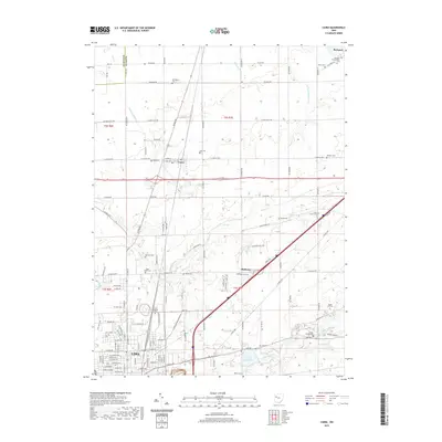
2019 Map of Cairo
USGS Topo · Published 2019About this map
Lima and its northern neighbors define this portion of Allen County, where the transition from city blocks to agricultural townships is marked by numerous family and community cemeteries. The northern edge of the city features the State Hospital Cem and the Lima Reservoir, illustrating the infrastructure and social history of the regional hub. To the north, the village of Cairo sits at the intersection of several local routes, while the smaller settlement of Slabtown is situated near the Ottawa River.
Find a feature on this map
118 named features on this map. Tap any name to fly to it.
Don’t see what you’re looking for? This feature index may not catch every label — zoom into the map to look around manually.
Map Details
Editions of this 2019 Cairo Map
This is the sole edition of this map. No revisions or reprints were ever made.
Other maps of this area

1906 · Lima
USGS Topo · 1:62,500

1906 · Columbus Grove
USGS Topo · 1:62,500

1907 · Bluffton
USGS Topo · 1:62,500

1908 · Columbus Grove
USGS Topo · 1:62,500

1913 · Alger
USGS Topo · 1:48,000

1915 · Alger
USGS Topo · 1:62,500

1943 · Alger
USGS Topo · 1:62,500

1950 · Marion
USGS Topo · 1:250,000

1953 · Muncie
USGS Topo · 1:250,000

1956 · Muncie
USGS Topo · 1:250,000