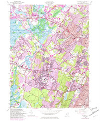
1954 Map of Caldwell
USGS Topo · Published 1982About this map
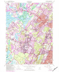
The Passaic River and its broad marshes define the western edge of this mid-century landscape, where the meandering Whippany River and Rockaway River converge near Pine Brook. To the east, the suburban expansion of Livingston, West Caldwell, and Essex Fells climbs the slopes toward the Watchung Mountains. This edition, photorevised in the early 1980s, captures the intense infill of residential neighborhoods and institutional growth, including the Caldwell College for Women and the Northeastern Bible Institute. The map illustrates a high density of educational and religious sites, from the Amos W Harrison Sch to Trinity Covenant Church. Large tracts of preserved land like the South Mountain Reservation contrast with industrial and utility features such as the Canoe Brook Reservoir No 1 and various radio towers, reflecting the complex development of the Essex County and Morris County borderlands.
Find a feature on this map
113 named features on this map. Tap any name to fly to it.
Don’t see what you’re looking for? This feature index may not catch every label — zoom into the map to look around manually.
Map Details
Editions of this 1954 Caldwell Map
6 editions found
Other maps of this area

1888 · Plainfield
USGS Topo · 1:62,500

1888 · Morristown
USGS Topo · 1:62,500

1888 · Paterson
USGS Topo · 1:62,500

1892 · Paterson
USGS Topo · 1:62,500

1893 · Plainfield
USGS Topo · 1:62,500

1894 · Morristown
USGS Topo · 1:62,500

1898 · Morristown
USGS Topo · 1:62,500

1898 · Plainfield
USGS Topo · 1:62,500

1898 · Staten Island
USGS Topo · 1:62,500

1898 · Paterson
USGS Topo · 1:62,500