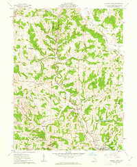
1961 Map of Caldwell North
USGS Topo · Published 1963About this map
Duck Creek and its many forks define the rugged landscape of central Noble County in the early 1960s. The Pennsylvania railroad line tracks the creek bed, serving a string of small coal-era settlements including Belle Valley, Coal Ridge, and Glenwood. The topography is heavily shaped by local industry, with several Strip Mine sites and a Claypit with associated Kilns north of Ava. Rural life centers on well-distributed community landmarks like the Buffalo Sch, Mt Zion church, and several family-named burial grounds such as McElroy Cem. The southern edge of the survey captures the outskirts of Caldwell, where the Waterworks and Caldwell Lake reflect the infrastructure of the county seat. This detailed record preserves the locations of numerous upland farms and ridge-top churches like Clarks Chapel before many were reached by modern development.
Find a feature on this map
63 named features on this map. Tap any name to fly to it.
Don’t see what you’re looking for? This feature index may not catch every label — zoom into the map to look around manually.
Map Details
Editions of this 1961 Caldwell North Map
3 editions found
Other maps of this area

1903 · Macksburg
USGS Topo · 1:62,500

1905 · Macksburg
USGS Topo · 1:62,500

1909 · Caldwell
USGS Topo · 1:62,500

1909 · Summerfield
USGS Topo · 1:62,500

1911 · Cumberland
USGS Topo · 1:62,500

1911 · Summerfield
USGS Topo · 1:62,500

1912 · Caldwell
USGS Topo · 1:62,500

1949 · Clarksburg
USGS Topo · 1:250,000

1956 · Clarksburg
USGS Topo · 1:250,000

1961 · Clarksburg
USGS Topo · 1:250,000