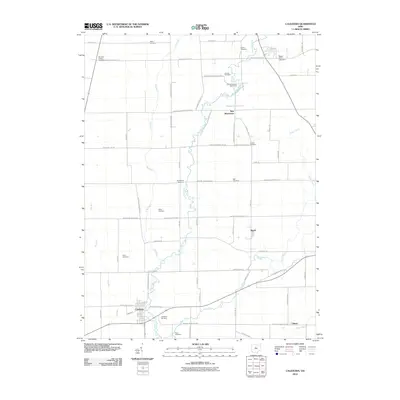
2010 Map of Caledonia
USGS Topo · Published 2010About this map
Caledonia sits at the convergence of several rural thoroughfares in Marion County, serving as a primary settlement in a landscape defined by meandering watercourses and family-named cemeteries. The Olentangy River winds through the center of this region, joined by tributaries such as Mud Run and Flat Run. This 2010 survey illustrates the persistence of small community centers like New Winchester, Martel, and Climax, which remain connected by an organized grid of section-line roads. Genealogists will find a high density of burial grounds throughout the countryside, including Brucklacher Cemetery, Sixteen Cemetery, and the Monnett Chapel Cemetery adjacent to Monnett Chapel. The presence of the Sugar Grove Lake Dam and the New Winchester Golf Course indicates how the land has been adapted for recreation and water management alongside traditional agricultural uses. Tracing the routes of Caledonia Mud Pike and Marion Galion Rd reveals the historic transport skeleton that continues to support these crossroads towns.
Find a feature on this map
64 named features on this map. Tap any name to fly to it.
Don’t see what you’re looking for? This feature index may not catch every label — zoom into the map to look around manually.
Map Details
Editions of this 2010 Caledonia Map
This is the sole edition of this map. No revisions or reprints were ever made.
Other maps of this area

1903 · Marion
USGS Topo · 1:62,500

1905 · Marion
USGS Topo · 1:62,500

1906 · Sycamore
USGS Topo · 1:62,500

1913 · Mount Gilead
USGS Topo · 1:62,500

1915 · Bucyrus
USGS Topo · 1:62,500

1916 · Mount Gilead
USGS Topo · 1:62,500

1943 · Bucyrus
USGS Topo · 1:62,500

1943 · Mount Gilead
USGS Topo · 1:62,500

1950 · Marion
USGS Topo · 1:250,000

1960 · North Robinson
USGS Topo · 1:24,000