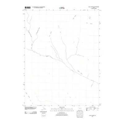
2011 Map of Calf Canyon
USGS Topo · Published 2011About this map
Cunningham Ranch stands as a focal point of human activity within this arid landscape, situated where the Windy Mesa Rd crosses the upper reaches of Nash Wash. This map documents a region of Grand County defined by intricate drainage systems and deep topographical features, including Calf Canyon, Coal Canyon, and Bull Canyon. The terrain rises toward the broad heights of Windy Mesa, while the northern portion of the quadrangle includes the open space of Turper Park. The map's network of intermittent watercourses, such as Strychnine Wash, Pinto Wash, and Segers Wash, illustrates the seasonal hydrology essential for ranching and survival in the high desert. The presence of Sagers Canyon and several unnamed 4WD tracks suggests a landscape primarily utilized for grazing and transit between the canyon floors and the mesas.
Find a feature on this map
16 named features on this map. Tap any name to fly to it.
Don’t see what you’re looking for? This feature index may not catch every label — zoom into the map to look around manually.
Map Details
Editions of this 2011 Calf Canyon Map
This is the sole edition of this map. No revisions or reprints were ever made.
Other maps of this area

1885 · East Tavaputs
USGS Topo · 1:250,000

1885 · La Sal
USGS Topo · 1:250,000

1956 · Moab
USGS Topo · 1:250,000

1956 · Grand Junction
USGS Topo · 1:250,000

1958 · Thompson
USGS Topo · 1:62,500

1958 · Cisco
USGS Topo · 1:62,500

1959 · Grand Junction
USGS Topo · 1:250,000

1959 · Moab
USGS Topo · 1:250,000

1960 · Moab
USGS Topo · 1:250,000

1960 · Grand Junction
USGS Topo · 1:250,000