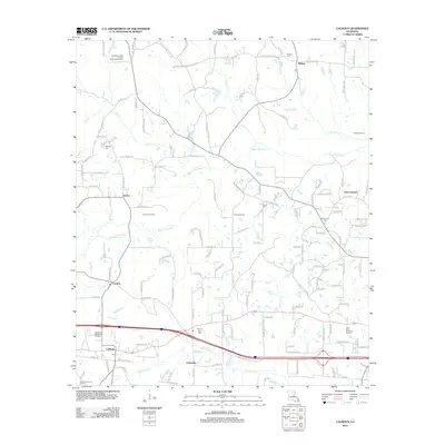
2012 Map of Calhoun
USGS Topo · Published 2012About this map
Calhoun serves as a primary hub of settlement in this northern Louisiana landscape, where Interstate 20 intersects with the traditional agricultural and timber lands of Ouachita Parish. The terrain is defined by the winding course of Bayou Choudrant, which meanders across the center of the sheet, and the southern wetlands of N Cheniere Cr. Smaller communities like Eureka and Wilhite anchor the rural road network, while several historic burial grounds including Mount Zion Cem and Butler Cem offer important points of interest for genealogical research. The presence of the Carlton Gas Field and Drew Gas Field underscores the region's energy production history. Extensive recreational spaces are also evident, including the Ouachita Valley Council Scout Reservation in the northwest and Camp Ch-Yo-Ca further south, illustrating how this landscape balances industrial use with community education and preservation.
Find a feature on this map
147 named features on this map. Tap any name to fly to it.
Don’t see what you’re looking for? This feature index may not catch every label — zoom into the map to look around manually.
Map Details
Editions of this 2012 Calhoun Map
This is the sole edition of this map. No revisions or reprints were ever made.
Other maps of this area

1935 · Drew
USGS Topo · 1:62,500

1940 · Monroe
USGS Topo · 1:62,500

1952 · Calhoun
USGS Topo · 1:62,500

1953 · Chatham
USGS Topo · 1:62,500

1955 · Shreveport
USGS Topo · 1:250,000

1956 · Shreveport
USGS Topo · 1:250,000

1957 · Monroe North
USGS Topo · 1:62,500

1957 · West Monroe North
USGS Topo · 1:24,000

1957 · West Monroe South
USGS Topo · 1:24,000

1957 · Monroe South
USGS Topo · 1:62,500