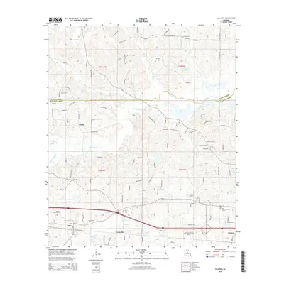
2015 Map of Calhoun
USGS Topo · Published 2015About this map
Calhoun and Forksville anchor the southern corridor of this landscape along the border of Ouachita and Union Parishes. The survey captures a transition from the structured academic grounds of the Louisiana Technical College-Delta-Ouachita Campus to the surrounding rural settlements of Eureka and Carlton. The area is characterized by a dense network of family-named roads, such as Lonnie Malone Rd and Wes Wilhite Rd, which reflect deep-seated local genealogies. Numerous burial sites including Roselawn Memorial Gardens and Butler Cem are scattered throughout, providing critical touchpoints for family history research. Significant waterways like Bayou Choudrant and N Cheniere Cr wind through the terrain, dictating the placement of early settlements and road crossings in this part of Northern Louisiana.
Find a feature on this map
123 named features on this map. Tap any name to fly to it.
Don’t see what you’re looking for? This feature index may not catch every label — zoom into the map to look around manually.
Map Details
Editions of this 2015 Calhoun Map
This is the sole edition of this map. No revisions or reprints were ever made.
Other maps of this area

1935 · Drew
USGS Topo · 1:62,500

1940 · Monroe
USGS Topo · 1:62,500

1952 · Calhoun
USGS Topo · 1:62,500

1953 · Chatham
USGS Topo · 1:62,500

1955 · Shreveport
USGS Topo · 1:250,000

1956 · Shreveport
USGS Topo · 1:250,000

1957 · Monroe North
USGS Topo · 1:62,500

1957 · West Monroe North
USGS Topo · 1:24,000

1957 · West Monroe South
USGS Topo · 1:24,000

1957 · Monroe South
USGS Topo · 1:62,500