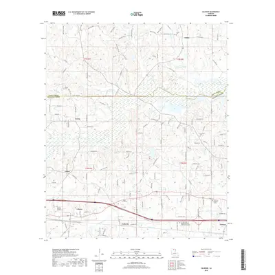
2018 Map of Calhoun
USGS Topo · Published 2018About this map
Bayou Choudrant meanders across this landscape north of the Interstate 20 corridor, defining a region of wooded drainages and small settlements along the border of Union Parish and Ouachita Parish. The map centers on rural communities like Eureka and Carlton, while the southern edge follows the developed transit line connecting Calhoun and Forksville. Local history is anchored by several family and community burial grounds, including Wilhite Cem in the north and the Twin Cities Memorial Gardens further east. Modern education is represented by the Louisiana Delta Community College West Monroe Campus, positioned near the historical crossroads of the area. This survey documents the intersection of rural parish life with the expanding infrastructure of northern Louisiana, where watercourses like Curry Cr and N Cheniere Cr still dictate the placement of local roads and farmsteads.
Find a feature on this map
131 named features on this map. Tap any name to fly to it.
Don’t see what you’re looking for? This feature index may not catch every label — zoom into the map to look around manually.
Map Details
Editions of this 2018 Calhoun Map
This is the sole edition of this map. No revisions or reprints were ever made.
Other maps of this area

1935 · Drew
USGS Topo · 1:62,500

1940 · Monroe
USGS Topo · 1:62,500

1952 · Calhoun
USGS Topo · 1:62,500

1953 · Chatham
USGS Topo · 1:62,500

1955 · Shreveport
USGS Topo · 1:250,000

1956 · Shreveport
USGS Topo · 1:250,000

1957 · Monroe North
USGS Topo · 1:62,500

1957 · West Monroe North
USGS Topo · 1:24,000

1957 · West Monroe South
USGS Topo · 1:24,000

1957 · Monroe South
USGS Topo · 1:62,500