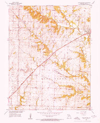
1953 Map of Calhoun West
USGS Topo · Published 1955About this map
The Missouri Kansas Texas railroad cuts a diagonal path through Henry County, serving as the primary corridor for commerce and settlement in this western Missouri landscape. The town of Calhoun and the smaller station at Lewis anchor the rail line, surrounded by a network of rural schoolhouses and churches that suggest a closely knit agricultural community. Distinctive local landmarks like Drakes Chapel and Mt Gilead Ch provide vital touchstones for family historians tracing early residents of the Shawnee and Deer Creek townships.
Find a feature on this map
30 named features on this map. Tap any name to fly to it.
Don’t see what you’re looking for? This feature index may not catch every label — zoom into the map to look around manually.
Map Details
Editions of this 1953 Calhoun West Map
Other maps of this area

1885 · Warrensburg
USGS Topo · 1:125,000

1887 · Clinton
USGS Topo · 1:125,000

1887 · Warrensburg
USGS Topo · 1:125,000

1894 · Warrensburg
USGS Topo · 1:125,000

1894 · Clinton
USGS Topo · 1:125,000

1947 · Jefferson City
USGS Topo · 1:250,000

1953 · Gaines
USGS Topo · 1:24,000
1953 · Calhoun East
USGS Topo · 1:24,000

1953 · Clinton South
USGS Topo · 1:24,000

1953 · Calhoun West
USGS Topo · 1:24,000