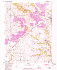
1953 Map of Calhoun West
USGS Topo · Published 1982About this map
The Missouri Kansas Texas railroad cuts a diagonal path through this rural Henry County landscape, serving the small settlements of Calhoun and Lewis. The terrain is defined by the drainage of West Fork Tebo Creek and its many tributaries, such as Sand Creek and Deer Creek, which create a complex network of ridges and bottoms. This area reflects a mid-century Missouri agricultural and extractive economy, evidenced by the presence of the Redding Mine and a local Gravel Pit.
Find a feature on this map
31 named features on this map. Tap any name to fly to it.
Don’t see what you’re looking for? This feature index may not catch every label — zoom into the map to look around manually.
Map Details
Editions of this 1953 Calhoun West Map
Other maps of this area

1885 · Warrensburg
USGS Topo · 1:125,000

1887 · Clinton
USGS Topo · 1:125,000

1887 · Warrensburg
USGS Topo · 1:125,000

1894 · Warrensburg
USGS Topo · 1:125,000

1894 · Clinton
USGS Topo · 1:125,000

1947 · Jefferson City
USGS Topo · 1:250,000

1953 · Gaines
USGS Topo · 1:24,000
1953 · Calhoun East
USGS Topo · 1:24,000

1953 · Clinton South
USGS Topo · 1:24,000

1953 · Calhoun West
USGS Topo · 1:24,000