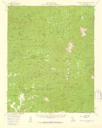
1958 Map of California Hot Springs
USGS Topo · Published 1959About this map
California Hot Springs serves as a central hub in this late-1950s survey of the southern Sierra Nevada, where the resort and Lewis Flat Campground sit near the confluence of Deer Creek and Tyler Creek. The landscape is a network of mid-century forest industry and seasonal camps, including timber operations like Guernsey Mill and the company town of Johnsondale on the South Fork Kern River. In the western reaches, the Tule River Indian Reservation encompasses landmarks such as Lone Pine Mtn and Devils Den. Notable for researchers are the numerous remote outposts and family-named features like Vincent Ranch, the Eagle Hotel, and McDermott Camp. Small-scale mining is evident through several sites such as the Tungstore Mine, Silver Strand Mine, and the Bull Point Mine located near Tyler Peak.
Find a feature on this map
216 named features on this map. Tap any name to fly to it.
Don’t see what you’re looking for? This feature index may not catch every label — zoom into the map to look around manually.
Map Details
Editions of this 1958 California Hot Springs Map
3 editions found
Other maps of this area

1904 · Kaweah
USGS Topo · 1:125,000

1905 · Olancha
USGS Topo · 1:125,000

1905 · Fairview
USGS Topo · 1:24,000

1906 · Kernville
USGS Topo · 1:125,000

1907 · Olancha
USGS Topo · 1:125,000

1908 · Kernville
USGS Topo · 1:125,000

1909 · Kaweah
USGS Topo · 1:125,000

1918 · Fairview
USGS Topo · 1:31,680

1920 · Delonagha
USGS Topo · 1:62,500

1926 · Glennville
USGS Topo · 1:62,500