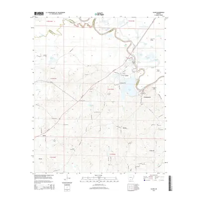
2014 Map of Calion
USGS Topo · Published 2014About this map
The Ouachita River defines the northern reaches of this landscape, winding through a complex of wetlands including Tupelo Gum Brake, Cobeen Brake, and Cross Current Slough. This region on the border of Union and Calhoun counties is heavily defined by its petroleum history, with active production areas like the Smackover Oil and Gas Field and Champagnolle Landing Oil Field interspersed among the wooded bottoms and ridges. For genealogists, the map is particularly dense with family-named burial sites such as Langford Cem, Champagnolle Castleberry Cem, and the Newton Dunaway Cem. Small settlements like Champagnolle and Calion serve as focal points for a network of rural routes, including Paw Paw Patch Rd and Union Road 344, which navigate the terrain between Smackover Cr and Calion Lake.
Find a feature on this map
99 named features on this map. Tap any name to fly to it.
Don’t see what you’re looking for? This feature index may not catch every label — zoom into the map to look around manually.
Map Details
Editions of this 2014 Calion Map
This is the sole edition of this map. No revisions or reprints were ever made.
Other maps of this area

1927 · El Dorado
USGS Topo · 1:62,500

1930 · El Dorado
USGS Topo · 1:62,500

1933 · Strong
USGS Topo · 1:62,500

1934 · Moro Bay
USGS Topo · 1:62,500

1937 · Strong
USGS Topo · 1:62,500

1938 · Moro Bay
USGS Topo · 1:62,500

1939 · Moro Bay
USGS Topo · 1:62,500

1939 · Strong
USGS Topo · 1:62,500

1951 · El Dorado
USGS Topo · 1:62,500

1953 · El Dorado
USGS Topo · 1:250,000