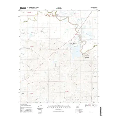
2017 Map of Calion
USGS Topo · Published 2017About this map
The Ouachita River meanders through the heart of this Union County landscape, defining the boundaries of local life and industry. Along its banks, the settlement of Calion serves as a focal point near Crabapple Point and Calion Lake. Further downstream, the river passes the historic site of Champagnolle, once a vital steamboat landing. The surrounding bottomlands are a complex network of backwaters and sloughs, including Bangs Slough, Tupelo Gum Brake, and Cobeen Brake, reflecting the wet timberland environment of southern Arkansas.
Find a feature on this map
94 named features on this map. Tap any name to fly to it.
Don’t see what you’re looking for? This feature index may not catch every label — zoom into the map to look around manually.
Map Details
Editions of this 2017 Calion Map
This is the sole edition of this map. No revisions or reprints were ever made.
Other maps of this area

1927 · El Dorado
USGS Topo · 1:62,500

1930 · El Dorado
USGS Topo · 1:62,500

1933 · Strong
USGS Topo · 1:62,500

1934 · Moro Bay
USGS Topo · 1:62,500

1937 · Strong
USGS Topo · 1:62,500

1938 · Moro Bay
USGS Topo · 1:62,500

1939 · Moro Bay
USGS Topo · 1:62,500

1939 · Strong
USGS Topo · 1:62,500

1951 · El Dorado
USGS Topo · 1:62,500

1953 · El Dorado
USGS Topo · 1:250,000